
We followed the Neretva to the sea – from Herzegovina’s mountains to the Adriatic
At Jablanica, the Neretva lies wedged between dramatic mountains. A few hours later, the landscape has opened up to fields, canals and the Mediterranean. We followed the road south and watched as one of the Balkans’ most characteristic rivers changes on its journey towards the Adriatic Sea.
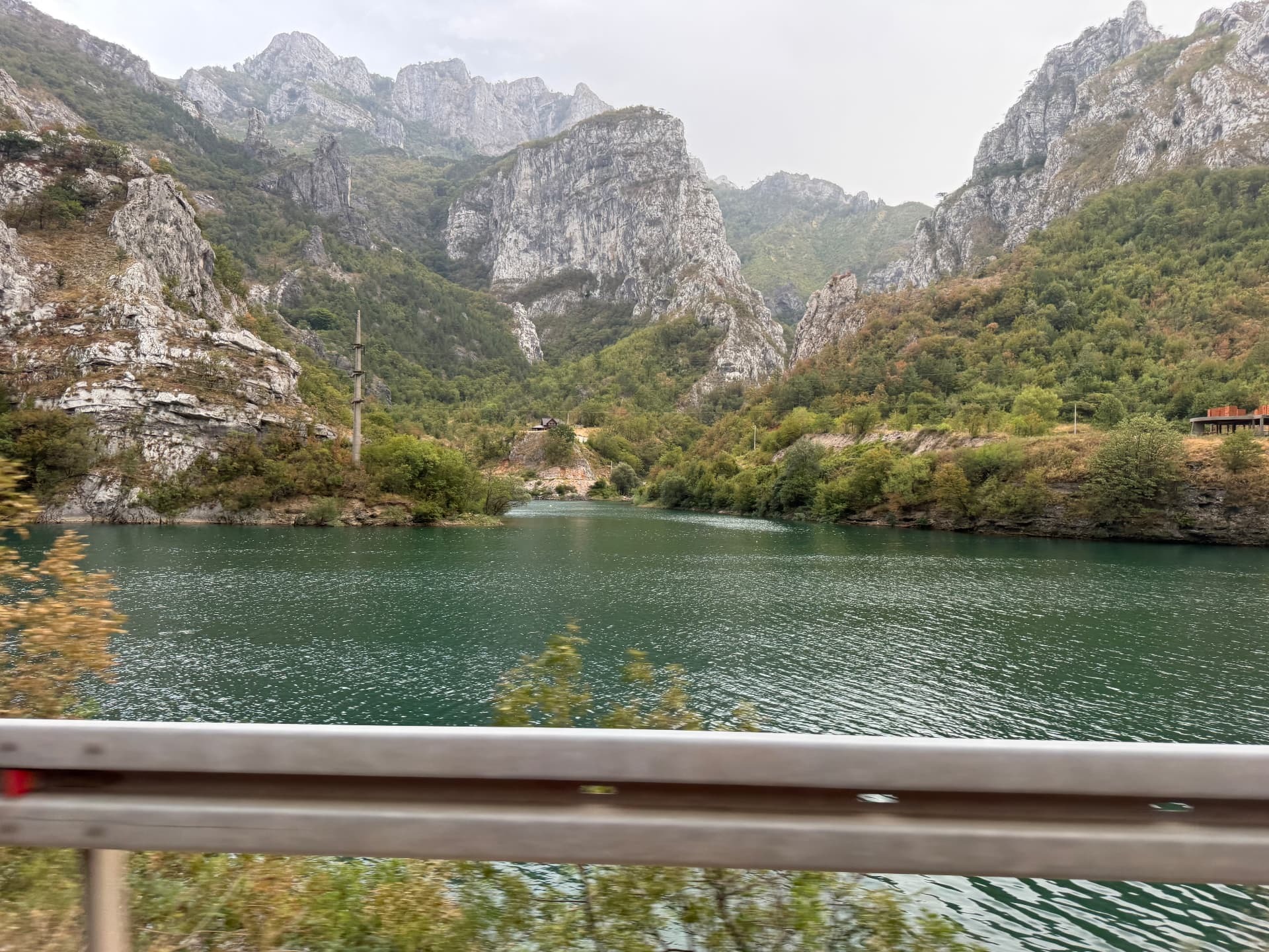
It begins between the mountains.
At Jablanica, it is hard to decide what catches the eye first – the water or the cliffs surrounding it.
The Neretva's deep green-blue colour stands in contrast to the pale limestone mountains. The road follows the water, disappearing behind cliffs and reappearing a few hundred metres further ahead.
Above, the rock faces rise almost vertically.
Here, the Neretva still feels like a mountain river.
But we are heading in the same direction as the water.
South.
Towards the sea.
A road that follows the river
To drive through Herzegovina along the Neretva is to watch the landscape change almost without noticing exactly when it happens.
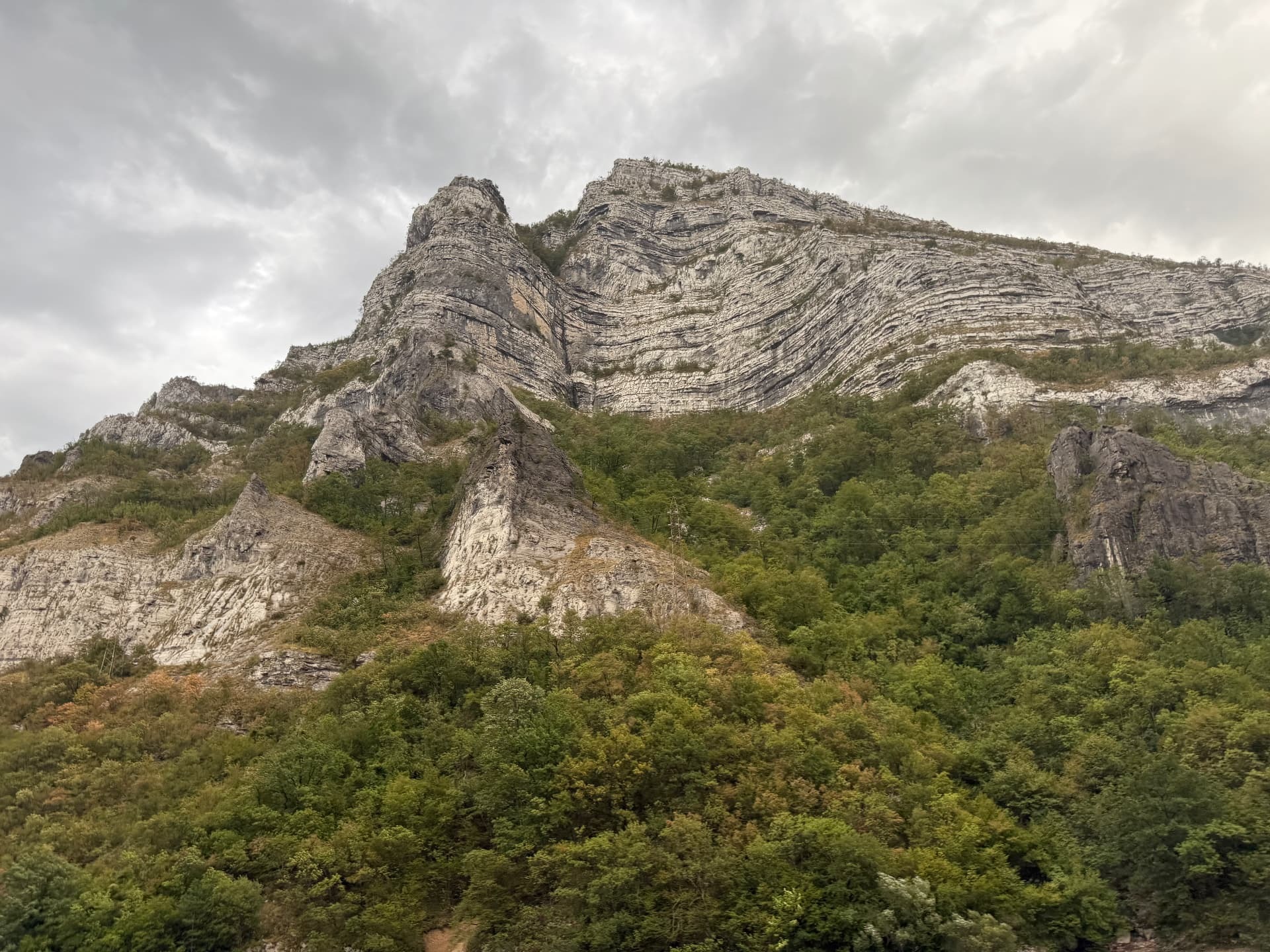
After Jablanica, the road continues between mountains that look as if they have been folded and squeezed together. Layer upon layer of rock is visible on the slopes – traces of geological forces that have shaped the landscape over millions of years.
Below is the Neretva.
Sometimes right beside the road. Sometimes hidden behind trees or mountains.
Then the valley opens up again.
It is a strange companion. You do not have to actively look for the river. It constantly reappears.
And the further south you go, the more the world around it changes.
From Jablanica to Mostar
The Neretva originates high in the Dinaric Alps of Bosnia and Herzegovina and flows for about 225 kilometres before reaching the Adriatic Sea.
But along the way, it is never just a river.
It shapes valleys, passes through towns, sustains agriculture and has for generations been a natural route through a landscape otherwise dominated by mountains.
On the stretch from Jablanica towards Mostar, this becomes particularly clear.
The mountains are still present, but Herzegovina gradually begins to change.
The vegetation shifts. The light feels different. The valley becomes wider.
And further ahead, Mostar awaits.
Here, the Neretva flows straight through the city, under the bridges and between two banks that for centuries have lived with the river running between them.
But the water does not stop in Mostar.
Nor does the road.
The further south, the more open the landscape becomes
After Mostar, the mountains slowly begin to release their grip on the river.
They do not disappear.
They simply move further away.
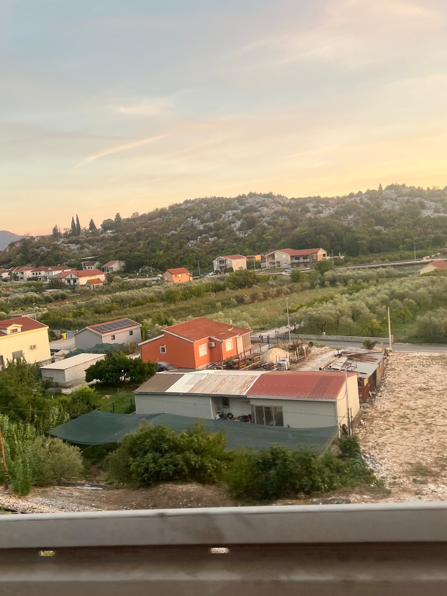
Around the road, cultivated fields multiply. Houses lie nestled between green fields. Olive trees, fruit trees and other vegetation take up more space.
The dramatic mountain river from Jablanica begins to look calmer.
It is still the same Neretva.
But the landscape around it is no longer the same.
It is perhaps this very change that is easy to miss when the sole goal of the journey is to reach the coast.
You pass through it.
But when you begin to follow the river with your eyes, the road becomes a different story.
Across the border
The Neretva does not care about national borders.
After flowing for most of its course through Bosnia and Herzegovina, it continues into Croatia. Only the final 20 kilometres or so of the river lie there.
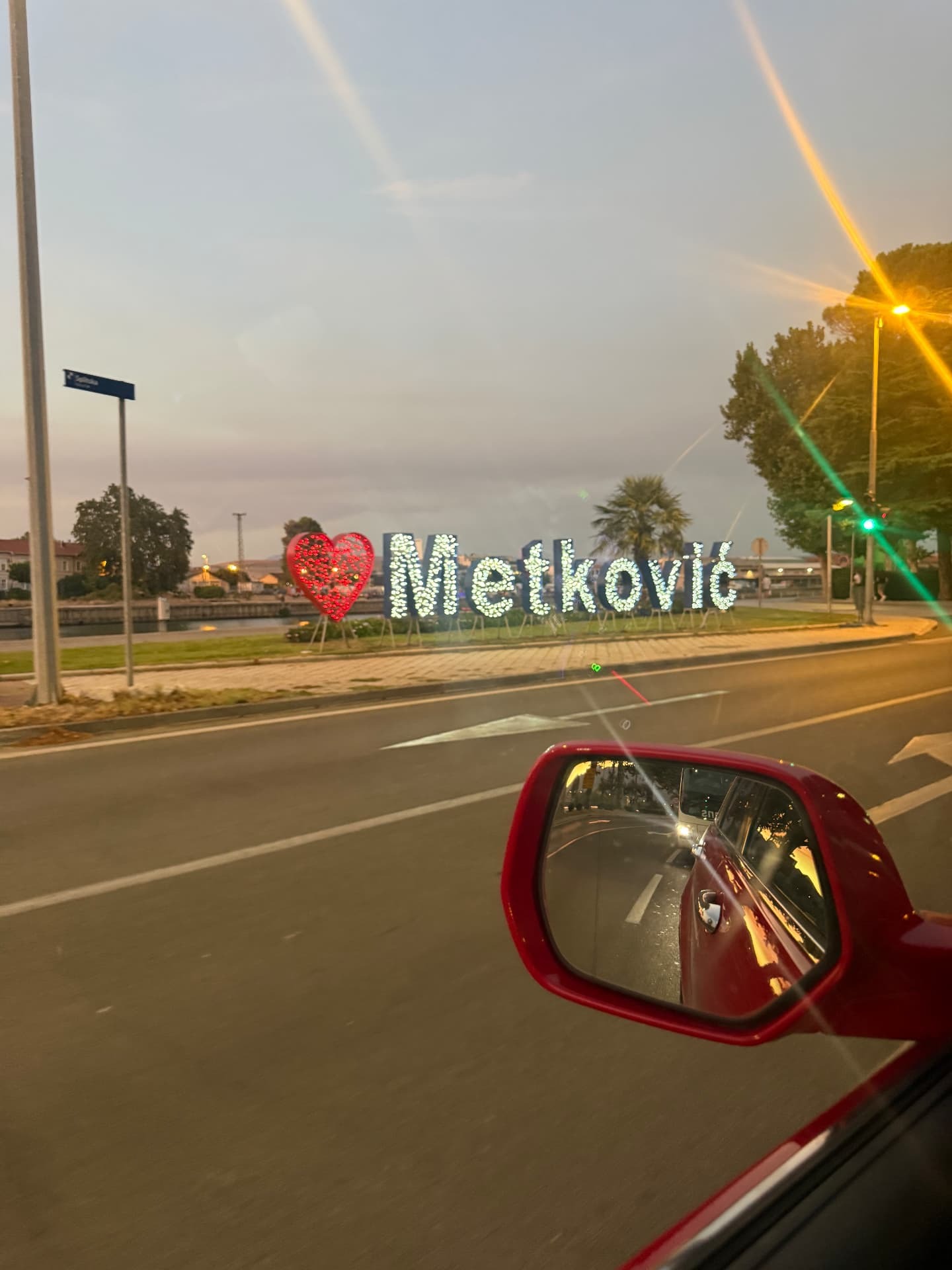
We pass Metković.
By the road, the town's name glows as the evening light begins to settle over the valley.
Here, the landscape has already changed completely compared to Jablanica.
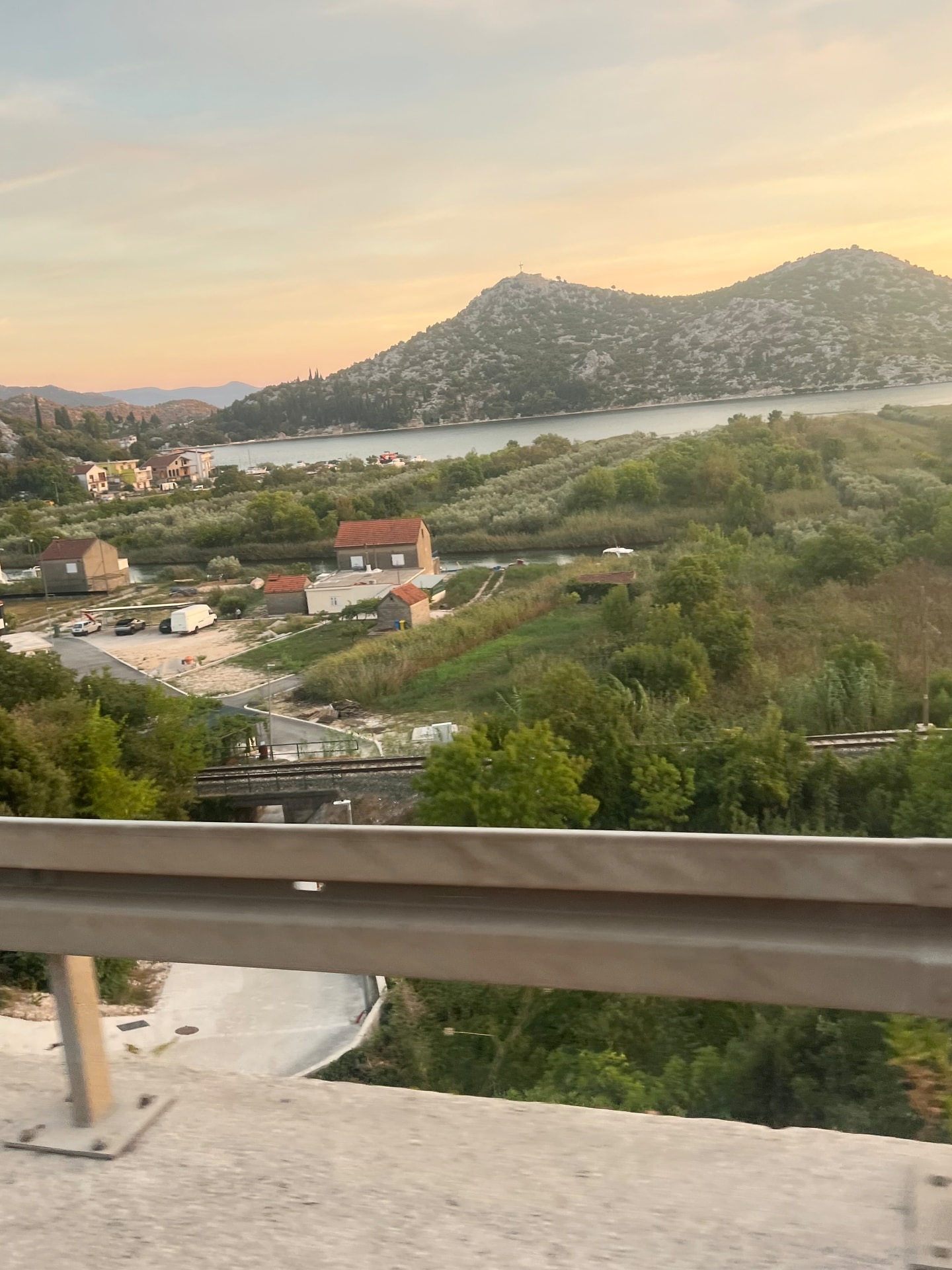
The towering rock faces have been replaced by a much more open area. Water and farmland lie side by side. Canals cut through the landscape.
We have reached the Neretva Delta.
Where a river becomes a landscape
The Neretva Delta is the only true river delta in Croatia.
Here, waterways divide a low-lying, fertile landscape before the Neretva reaches the Adriatic Sea.
It looks almost engineered from above.
Narrow green cultivated fields. Water canals. Wetlands. Roads. Small communities.
But the interplay between humans and the water has a long history here.
Land has been drained and cultivated, canals have been used for transport and irrigation, and the fertile soil has turned the valley into one of Croatia's most distinctive agricultural regions.
Above all, one fruit has become synonymous with the place:
the mandarin.
In autumn, the orange fruits glow amidst the green trees, and roadside sellers remind travellers that this is no longer the same barren mountain landscape of a few hours earlier.
The Neretva has gone from being wedged between cliffs to giving life to an entire valley.
One of the unique landscapes of the Adriatic coast
There is another reason why the delta is special.
It is one of the Mediterranean's key wetland areas and is internationally protected under the Ramsar Convention.
Around 310 bird species have been recorded in the area.
Wetlands, lagoons, reed beds and the river's various waterways provide food and shelter for both resident species and migratory birds passing through on their long journeys.
On the other side of the border lies Hutovo blato in Bosnia and Herzegovina.
For the birds flying above the Neretva, there is no border control.
The two wetlands are parts of the same larger ecological system.
Just like the river itself.
Ploče and the final kilometres
Further west lies Ploče.
The town is perhaps not the first place that comes to mind when thinking of the Croatian Adriatic coast.
And it is not really the town that is the main character here.
It is the geography.
Within a very short distance, river, delta, lakes, mountains and the Adriatic Sea meet.
The Neretva has travelled through most of Herzegovina before arriving here.
Konjic.
Jablanica.
Mostar.
Čapljina.
Metković.
And finally, the area around Ploče.
After that, there is no more land to cross.
Where the Neretva meets the Adriatic Sea
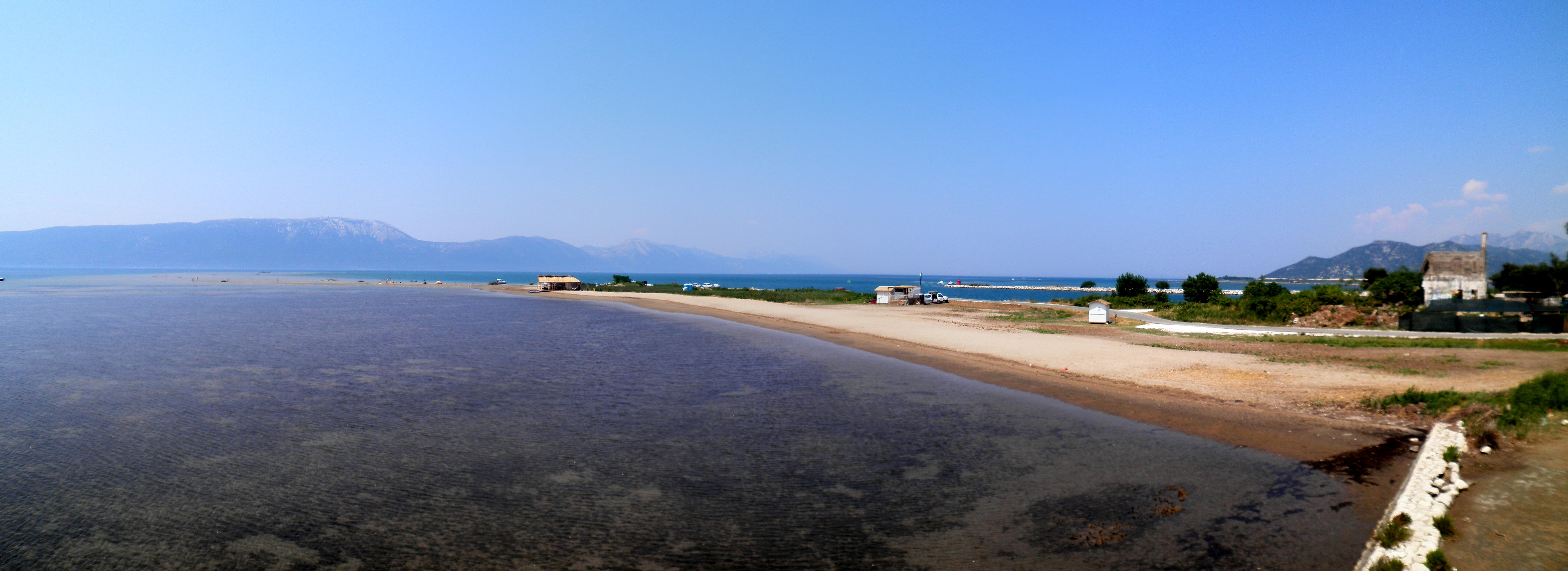
At the mouth, the landscape becomes even more open.
The river water meets the saltwater of the Adriatic. Sandbanks and shallow waters stretch out towards the coast, while the wind has made the area around the mouth famous among kitesurfers, among others.
It is hard to reconcile that image with the Neretva at Jablanica.
There, the mountains crowded closely around the water.
Here, there is the horizon.
Yet, it is the same river.
And it is only when you see the two landscapes one after the other that the distance between them feels less geographical and more visual.
In a few hours, we have gone from almost vertical rock faces and dark green water to fields, canals, wetlands and a sea opening up before the river.
One river, two countries
On the map, there is a clear line between Bosnia and Herzegovina and Croatia.
In the landscape, the story is more continuous.
The water passing through Herzegovina continues towards the same sea. Roads, trade, people and culinary traditions have long followed the same natural corridor.
Perhaps that is why the Neretva is more than a watercourse.
It is a connection.
Between the mountains and the sea.
Between the inland and the coast.
Between Bosnia and Herzegovina and the Adriatic Sea.
And somewhere on the way south, it becomes clear why a river can tell us more about a landscape than a national border can.
We began among the mountains at Jablanica.
As the Neretva continues towards Ploče, only the Adriatic Sea remains ahead of it.
The same water. A completely different landscape.
Sources & further reading
- Ramsar Sites Information ServiceNeretva River Delta
- Interreg IPA ADRIONIntroducing the TETHYS4ADRION pilot rivers: The Neretva River
- Croatian Medical Journal / PubMed CentralThe Neretva Delta: Green Pearl of Coastal Croatia
Share the article
Translated from Swedish with AI assistance. Read the original.


