
Retezat: from forest paths to steep high peaks
At Lacul Stânișoara, it is time to choose: stay by the lake or continue up into much steeper terrain. This very distinction makes Retezat an intriguing mountain range to get to know. Here, forested valleys meet the rocky high peaks of the Carpathians – but your hike does not have to end on a summit.
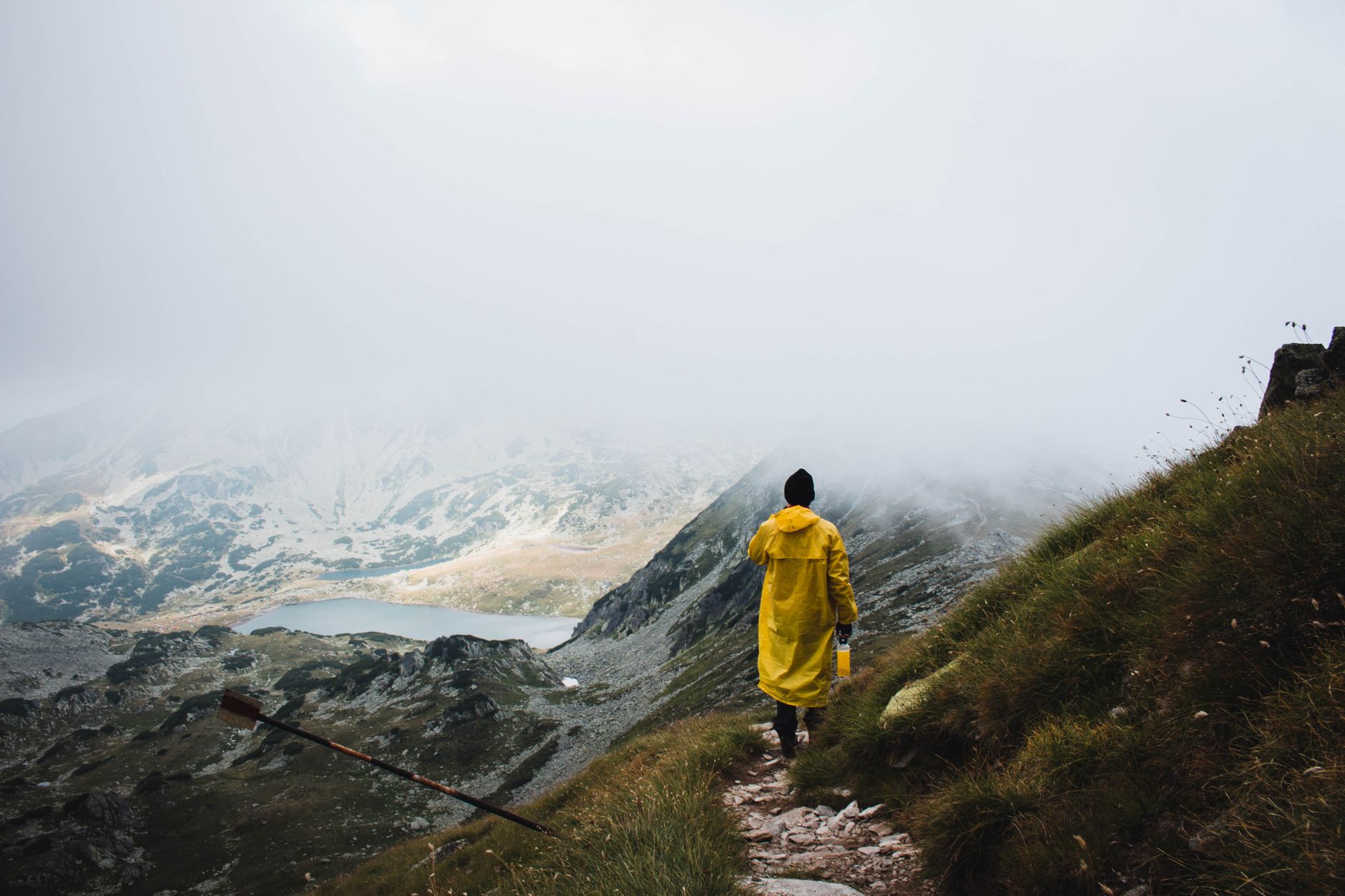
The lake is a destination in itself. On the hike from Cârnic via Pietrele towards Lacul Stânișoara, the landscape shifts from forest to open mountain terrain. As the valley opens up, the slopes and the rocky contours of the mountains stand revealed, free from the screen of trees. Here, you can choose to end your ascent, enjoy your packed lunch, and let the same valley lead you back.
Continuing towards Vârful Retezat is a separate decision. The park's route descriptions distinguish between the moderately difficult section up to the lake, at around 2,000 metres above sea level, and the significantly steeper climb beyond. While the lake and the summit are part of the same trail, they should not be treated as interchangeable destinations.
This is a good introduction to Retezat, in Romania's Southern Carpathians. For those familiar with the Nordic fells, there is much to recognise: rocks, water, low vegetation, and weather that dictates the day's choices. However, this experience needs to be translated to a different landscape, with different access points, mountain huts, and conservation rules.
The valley shapes the hike
From Cârnic, the northern entrance leads towards the area around Cabana Pietrele. The forest is not merely a transit zone before the peaks, but a defining part of the experience. Streams, roots, and rocks give the trail character before the views open up. Higher up, dwarf mountain pine and rockier ground take over.
Retezat was shaped by glaciation. The lakes lie in hollowed-out mountain basins, with steep sides and ridges dividing the valleys. This topography also explains why two lakes that appear close to each other on a map are not necessarily part of the same easy hike. Between them may lie a ridge or a pass that completely changes the nature of the trek.
The Stânișoara Valley provides a clear path up through the landscape. At the lake, the connection between valley floor, steep slope, and summit is easy to read. However, the view does not tell the whole story of what lies ahead: a peak that looks close may require a completely different level of effort than the stretch you have already covered.
So do not let the name of the summit dictate your entire day. The hike up to the lake has already showcased several of Retezat's distinct environments.
Three route ideas – with different starting points
Lacul Bucura is a name to look out for when reading about Retezat. The lake lies in a wide mountain basin, where the water surface lends a sense of space to an otherwise rocky landscape. The shorter route option to Bucura starts from Poiana Pelegii on the southern side of the massif.
The crucial word here is starts. A description of a short walk to Bucura says nothing about how long the day will be for someone starting at Pietrele on the northern side. From there, a route towards Bucura means heading deeper into the high mountains and crossing the Curmătura Bucurii pass. The same lake, but a completely different hike.
For those using Pietrele as a base, Lacul Stânișoara and Lacul Pietrele are two different lakeside destinations to explore. They lie in separate valleys. Cabana Gențiana is located along the path through the Pietrele Valley, and is not part of a route that naturally includes Stânișoara. The similarity of names between huts, lakes, and valleys makes it worthwhile to trace the entire route on a map.
A summit trek towards Vârful Retezat adds even more challenging terrain to the lakeside hike. It should be chosen as a dedicated, more demanding hike in its own right – not as a spontaneous extension just because you reached the lake sooner than expected.
Before any of these hikes become your daily plan, you will need an up-to-date route description with the correct starting point, elevation gain, trail markings, and return times. Distances in kilometres without this context are of little use when planning in the mountains.
Match your access point to your accommodation
A trip to Retezat makes sense once you choose which side of the massif to base yourself on before selecting lakes and peaks. Cârnic and Pietrele form a northern gateway. Poiana Pelegii is the starting point for a different type of itinerary from the south. Switching between them is not as simple as changing car parks at the foot of a small nature reserve.
Staying overnight inside the mountain range also changes the shape of your hiking days. A night at Pietrele offers a different starting point compared to a morning start further down. Cabana Pietrele and Cabana Gențiana are genuine trail landmarks, but the word cabana is not a guarantee of a certain standard, meal service, or the ability to turn up unannounced.
Contact the accommodation directly to ask about bookings, opening times, sleeping equipment, and food. You should also distinguish between a staffed hut and a shelter intended for more basic needs. A name on the map is not enough to determine what facilities will be available when you arrive.
Access requires the same care. Check the current road conditions, road standards, and where the drivable section actually ends before booking transport. In particular, a route that looks short from Poiana Pelegii must be evaluated alongside the journey to get there. Information regarding today's road conditions and the current service level at the huts has not been verified for this article.
Plan by conditions, not the calendar
Retezat should not be viewed as a collection of summer trails that function the same way as soon as a particular month begins. The snow situation on your chosen trail, the weather forecast, and conditions higher up must all factor into your decision. A general statement that an area is accessible year-round is not an assessment of a specific route.
Prior to your hike, the park administration and Salvamont Hunedoara, the local mountain rescue organisation, are valuable contacts for current advice. Ask for information specifically for the valley, pass, or peak you plan to visit. At the same time, check how to reach mountain rescue and save their contact details before setting off.
Keep an offline map available and follow the trail markers even when visibility is good. In fog, it is no longer obvious which depression leads to the correct lake. Always plan with enough margin to turn back, and let thunderstorm forecasts influence your choice of exposed ridges.
This is not an up-to-date safety assessment or a complete route guide. The point is to choose the right kind of hiking day: lakes, passes, and summits demand different things, even when they appear in the same route suggestion.
National park, not Swedish-style right to roam
In Parcul Național Retezat, camping is only permitted in designated areas. A flat, grassy patch by a lake is therefore not automatically a campsite. For those used to choosing their campsite freely in the Swedish mountains (under the right of public access, allemansrätten), this directly affects trip planning: overnight stays must be decided based on the park's designated sites, not just on how far your legs can carry you.
The Gemenele Reserve also requires special attention. Do not treat the protected area as a potential shortcut between trails; check the access conditions with the park administration. The same applies to current rules regarding dogs, campfires, and using stoves. Swedish habits offer no guidance on what is permitted here.
Respect for nature begins when you pack your rucksack. Arrange to carry out all your waste, keep your distance from wildlife, and leave the plants undisturbed. Avoid washing dishes or using soap directly in the lakes. The aquatic environments are a protected part of the national park, not just beautiful picnic spots.
Retezat rewards a plan that gives the landscape space. The forest on the way up, the opening of the valley, and the lake below the cliff do not have to be a prelude to something else. At Stânișoara, you can look towards the summit, assess the climb ahead, and still decide that today's hike has already reached its destination.
Facts
- Country/region: Romania, Southern Carpathians (Hunedoara County)
- Protection: Romania's first national park (1935), also a UNESCO biosphere reserve
- Highest peak: Peleaga, 2,509 m
- Key feature: around eighty glacial lakes
- Best season: summer and early autumn
Sources & further reading
Share the article
Translated from Swedish with AI assistance. Read the original.


